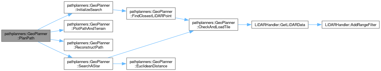
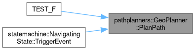
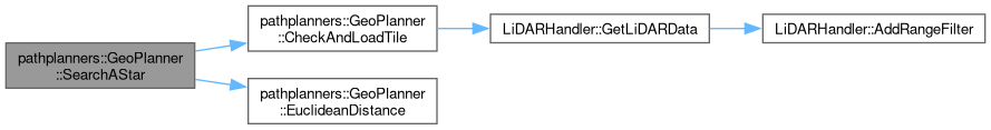
Perform the A* search algorithm to find the optimal path.
321 {
322
323 std::chrono::high_resolution_clock::time_point tmStartTime = std::chrono::high_resolution_clock::now();
324
325
326 PlannerState stStartState = m_umAllStates[m_nStartID];
327 stStartState.dGCost = 0.0;
328
330 stStartState.dNorthing,
331 stStartState.dAltitude,
332 m_umAllStates[m_nEndID].dEasting,
333 m_umAllStates[m_nEndID].dNorthing,
334 m_umAllStates[m_nEndID].dAltitude);
335
336 m_umAllStates[m_nStartID] = stStartState;
337
338
339 m_pqOpenSetNextBest.push(m_umAllStates[m_nStartID]);
340
341
342 while (!m_pqOpenSetNextBest.empty())
343 {
344
345 PlannerState stCurrentState = m_pqOpenSetNextBest.top();
346
347 m_pqOpenSetNextBest.pop();
348
349
350 std::unordered_map<int, pathplanners::GeoPlanner::PlannerState>::iterator itState = m_umAllStates.find(stCurrentState.nID);
351 if (itState == m_umAllStates.end())
352 {
353 continue;
354 }
355
356 if (stCurrentState.dGCost > itState->second.dGCost + 1e-9)
357 {
358
359 continue;
360 }
361
362
363 if (m_usClosedSet.find(stCurrentState.nID) != m_usClosedSet.end())
364 {
365 continue;
366 }
367
368
369 if (stCurrentState.nID == m_nEndID)
370 {
371 LOG_INFO(logging::g_qSharedLogger, "Goal reached in A* search.");
372 return;
373 }
374
375
376 m_usClosedSet.insert(stCurrentState.nID);
377
378
380
381
382 std::vector<LiDARHandler::PointRow> vNeighbors;
383 KDQueryPoint stQueryPoint{stCurrentState.dEasting, stCurrentState.dNorthing};
384 m_pKDTree->find_within_range(stQueryPoint, m_dSearchRadius, std::back_inserter(vNeighbors));
385
386
388 {
389
390 if (m_usClosedSet.find(stPoint.nID) != m_usClosedSet.end())
391 {
392 continue;
393 }
394
395
396
397
398
400 stCurrentState.dNorthing,
401 stCurrentState.dAltitude,
402 stPoint.dEasting,
403 stPoint.dNorthing,
404 stPoint.dAltitude);
405
406 double dScore = std::clamp(stPoint.dTraversalScore, 0.0, 1.0);
407
408 double dMultiplier = 1.0 + m_dBeta * (1.0 - dScore);
409
410 double dTentativeGCost = stCurrentState.dGCost + dDistance * dMultiplier;
411
412
413 std::unordered_map<int, PlannerState>::const_iterator itNeighborState = m_umAllStates.find(stPoint.nID);
414
415 if (itNeighborState == m_umAllStates.end() || dTentativeGCost + 1e-12 < itNeighborState->second.dGCost)
416 {
417
418 PlannerState stNeighborState;
419 stNeighborState.nID = stPoint.nID;
420 stNeighborState.dEasting = stPoint.dEasting;
421 stNeighborState.dNorthing = stPoint.dNorthing;
422 stNeighborState.dAltitude = stPoint.dAltitude;
423 stNeighborState.nZone = std::stoi(stPoint.szZone.substr(0, 2));
424 stNeighborState.bInNorthernHemisphere = (stPoint.dNorthing >= 0);
425 stNeighborState.dGCost = dTentativeGCost;
426
428 stNeighborState.dNorthing,
429 stNeighborState.dAltitude,
430 m_umAllStates[m_nEndID].dEasting,
431 m_umAllStates[m_nEndID].dNorthing,
432 m_umAllStates[m_nEndID].dAltitude);
433
434
435 m_umAllStates[stPoint.nID] = stNeighborState;
436
437 m_umPredecessors[stPoint.nID] = stCurrentState.nID;
438
439
440 m_pqOpenSetNextBest.push(stNeighborState);
441 }
442 }
443
444
445 if (m_usClosedSet.size() % 1000 == 0)
446 {
447 LOG_INFO(logging::g_qSharedLogger, "A* search progress: {} nodes evaluated.", m_usClosedSet.size());
448 }
449
450
451 std::chrono::high_resolution_clock::time_point tmCurrentTime = std::chrono::high_resolution_clock::now();
452 std::chrono::duration<double> dElapsedTime = tmCurrentTime - tmStartTime;
453 if (dElapsedTime.count() >= m_dMaxSearchTimeSeconds)
454 {
455 LOG_WARNING(logging::g_qSharedLogger, "A* search terminated after exceeding max search time of {} seconds.", m_dMaxSearchTimeSeconds);
456 return;
457 }
458 }
459 }
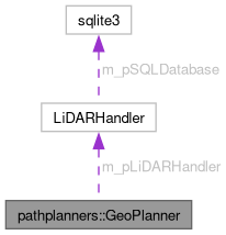
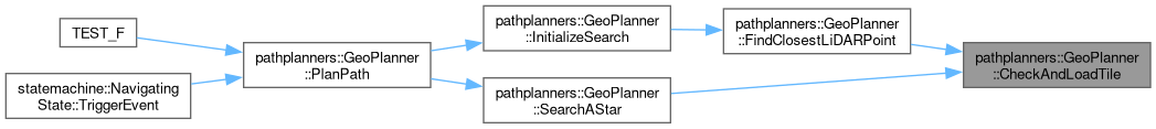
void CheckAndLoadTile(const PlannerState &stCurrentState)
Check if the tile containing the current state is loaded, and if not, load it.
Definition GeoPlanner.cpp:527
double EuclideanDistance(double dEasting1, double dNorthing1, double dAltitude1, double dEasting2, double dNorthing2, double dAltitude2) const
Calculate the distance between two UTM coordinates.
Definition GeoPlanner.cpp:762
Struct representing a single LiDAR point row from the database.
Definition LiDARHandler.h:53